Project Overview
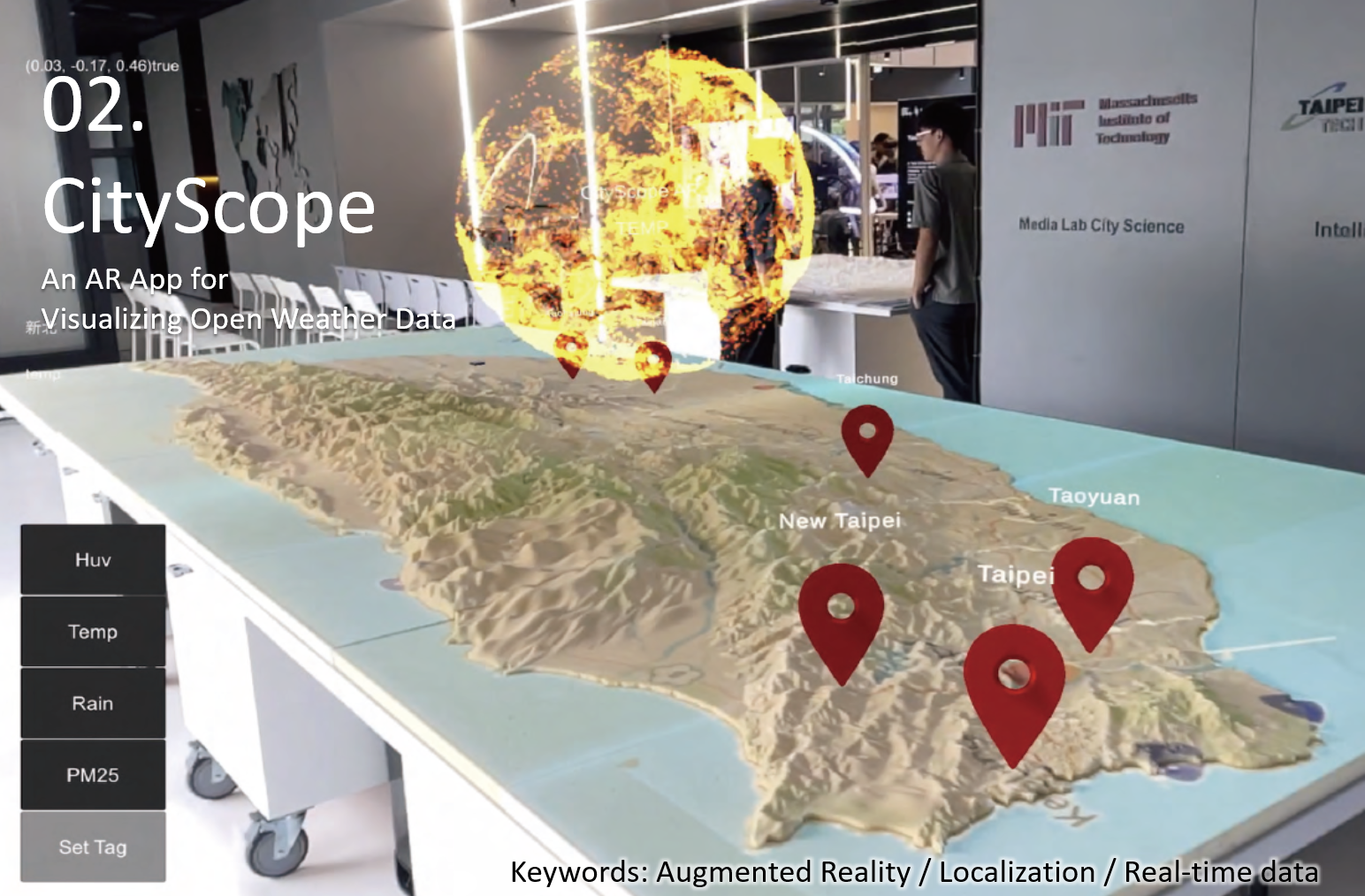
CityScope AR is an iOS augmented reality application developed during the MIT UROP program at City Science Lab @ Taipei (2023). The app overlays real-time 3D weather data from Taiwan's Central Weather Bureau directly onto a physical island tabletop model, enabling researchers and city planners to experience climate simulations in an intuitive spatial context.
Spatial registration is achieved through AprilTag marker detection and ARKit plane detection, maintaining centimeter-level accuracy between the virtual weather layers and the physical model surface.
Key Features
- AprilTag-based spatial anchoring with ARKit plane detection for robust model registration.
- Real-time weather data pipeline from Taiwan Central Weather Bureau (CWB) API — wind speed, precipitation, temperature.
- 3D volumetric wind vectors and rain particle systems rendered at correct geographic scale.
- Multi-layer toggle UI for switching between weather variables and time frames.