Abstract
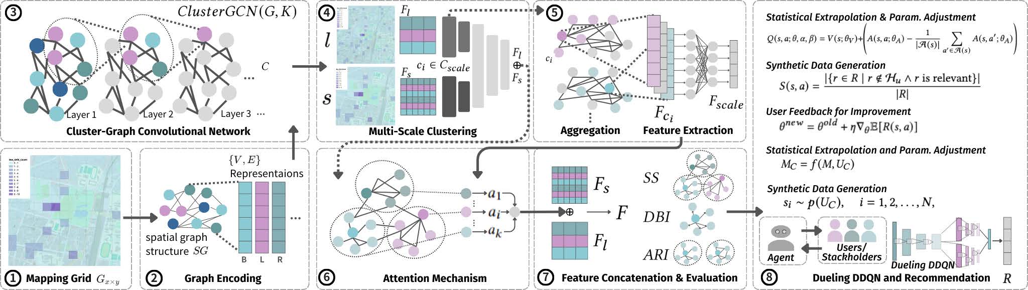
GreenSpot combines GIS-based augmented reality with a Cluster-GCN recommendation model to help commuters discover and choose greener public transport options. The system overlays real-time transit suggestions onto the physical city environment via a mobile AR interface, while the backend models spatial dependencies between bus stops, bike-share stations, and pedestrian flow patterns using graph convolutional networks.
Published at ACM SIGSPATIAL 2024, GreenSpot demonstrates how spatial graph learning can be coupled with on-site AR to create actionable, place-aware mobility recommendations.
Key Contributions
- Cluster-GCN architecture for scalable spatial recommendation over city-scale transit graphs.
- GIS data pipeline integrating OpenStreetMap, GTFS transit feeds, and weather sensors.
- Mobile AR interface (iOS / ARKit) that overlays route suggestions at physical bus stops.
- Field evaluation with commuters in Tainan City, Taiwan.
Technologies
BibTeX
@inproceedings{lai2024greenspot,
  title={GreenSpot: Improving Public Transport with GIS-Based AR and Cluster-GCN Recommendation},
  author={Lai, Shih-Yu and Hsieh, Tzu-Hsin and Ling, Sing-Kai and Tsai, Pei-Chi and Kung, Chao-Chun and Hsieh, Hsun-Ping},
  booktitle={Proceedings of the 32nd ACM International Conference on Advances in Geographic Information Systems},
  pages={689--692},
  year={2024}
}